Session Data
- Date: 09/02/2025
- Time: 16:09 – 17:09 UT
- Seeing: II. Good – Slight
- Transparency: III. Clear with slight haze
- Temp: 6 C,
- Air Pressure: 1028mb
- Humidity: 77%
- Dew Point: 2 C
- Wind Speed: 6 mph
- Average SQM:
Scope: Altair 250mm RC f/8 Camera: ZWO ASI 183MM.
- Distance: 380958Km
- Apparent diameter: 31.37′
- Phase: 34.9°
- Lunation: 11.14 days
- Illumination: 91.0%
- Colongitude: 50.2°
Lunar images are displayed North up and West to the left. Astronomik 742nm Pass filter
L14, Sinus Iridum
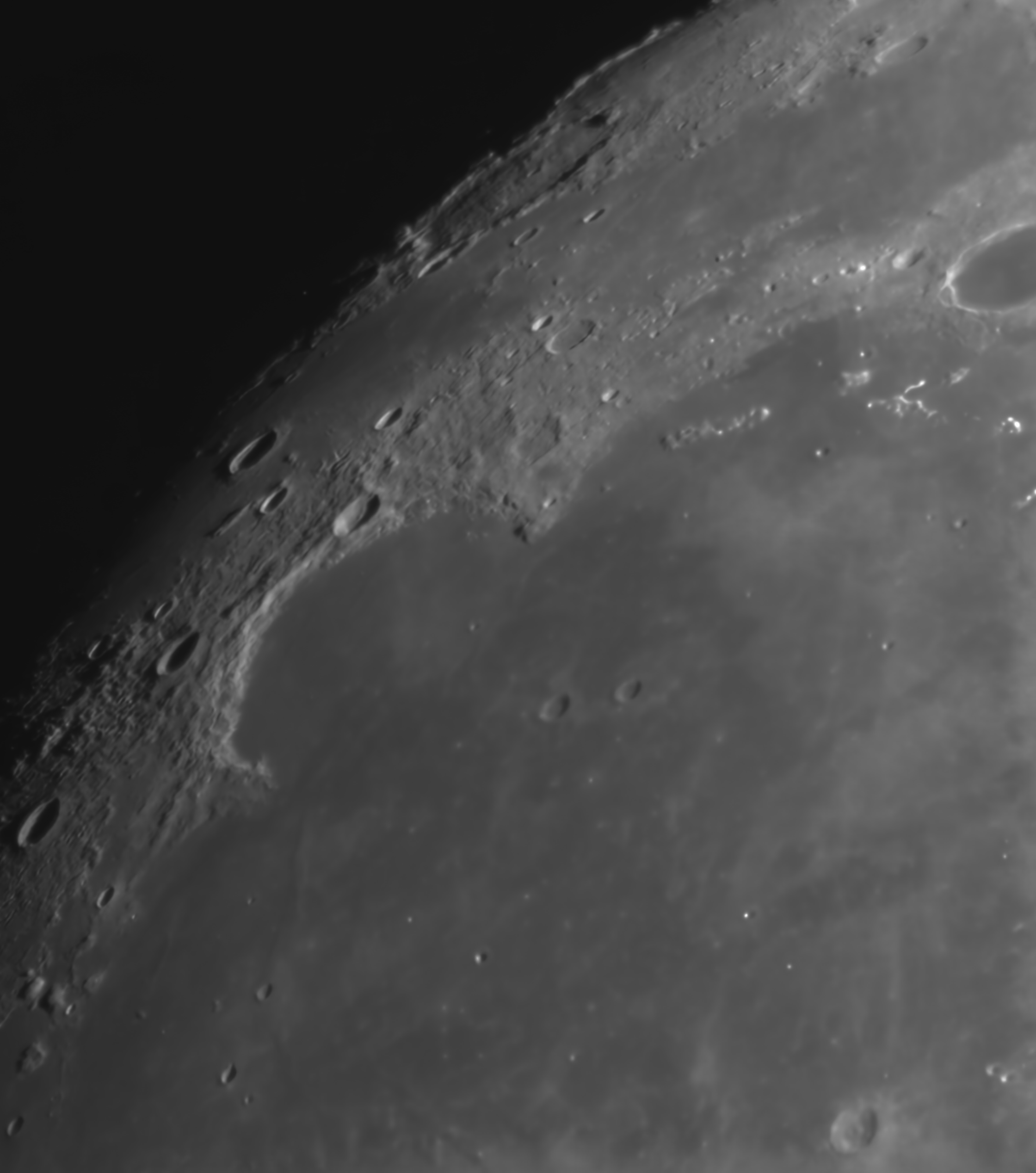

You can see why Charles Wood suggests that Sinus Iridum should really be called the Jura crater as the Jura mountains to the North and the connected rim that runs between the promontories Promontorium Heraclides and Promontorium Laplace. The rest of this rim is submerged by the lava flow of the Imbrium basin.
LROC shows a number of what I will call wrinkle ridges within the basin, but the scope is not resolving any of these. There is just a hint of the 4km crater Heraclides E to the West and the more easily seen Laplace A to the East.
The illumination from the East highlights the terracing rim to the West and I can just make out the 3 little islands on the Northeastern rim.
Outside of the rim at Promontorium Heraclides you can see buttresses of rock supporting the rim like you would see outside of a cathedral.
To the North and breaking into the Jura mountain rim is the large crater Bianchini. This looks like it has displaced the Jura rim at that point towards the South a little, thus creating a valley at the break.